The Dolomites, a mountain range situated in northeastern Italy across the regions of South Tyrol, Trentino, and Veneto, represent one of the most distinctive alpine environments in Europe. Designated as a UNESCO World Heritage site in 2009 for its extraordinary natural beauty and unique geological formations, the region spans over 142,000 hectares of protected land.
Understanding the Dolomites requires an analytical approach that evaluates three core dimensions: geological significance, cultural heritage, and contemporary visitor management. The geographical landscape is characterized by vertical limestone walls, dramatic spires, and expansive high-altitude alpine meadows. Culturally, the region functions as a tripartite linguistic and historical crossroads where Italian, German, and Ladin traditions intersect. Economically, the region balances traditional agricultural practices with a high-volume tourism sector that attracts millions of visitors annually.
Dolomites Regional Overview
├── Geography: Southern Limestone Alps (Trentino-Alto Adige/Südtirol, Veneto, Friuli Venezia Giulia)
├── UNESCO World Heritage Listing: 2009 (Criterion vii and viii)
├── Cultural Strata: Ladin, Italian, and Austro-Bavarian influences
└── Key Economic Drivers: High-altitude agriculture, eco-tourism, and winter sports infrastructure
Key Facts: The Dolomites
Geological Origin: Ancient coral reefs formed in the Tethys Ocean during the Triassic period (~250 million years ago).
Highest Peak: Marmolada, reaching 3,343 meters (10,968 feet) above sea level.
UNESCO Designation: 2009, covering nine sub-systems across five Italian provinces.
Linguistic Demographics: Multilingual population speaking Italian, German, and Ladin (a Rhaeto-Romance language).
Primary Access Hubs: Bolzano, Trento, Belluno, and Venice Marco Polo Airport.
Geological Heritage and the Enrosadira Phenomenon
The distinct physical appearance of the Dolomites stems from their unique mineral composition. Unlike the central Alps, which consist primarily of granite and gneiss, the Dolomites are largely composed of magnesium-rich carbonate rock known as dolomite. Named after the 18th-century French mineralogist Déodat de Dolomieu, this rock structure displays high resistance to erosion while remaining susceptible to vertical fracturing.
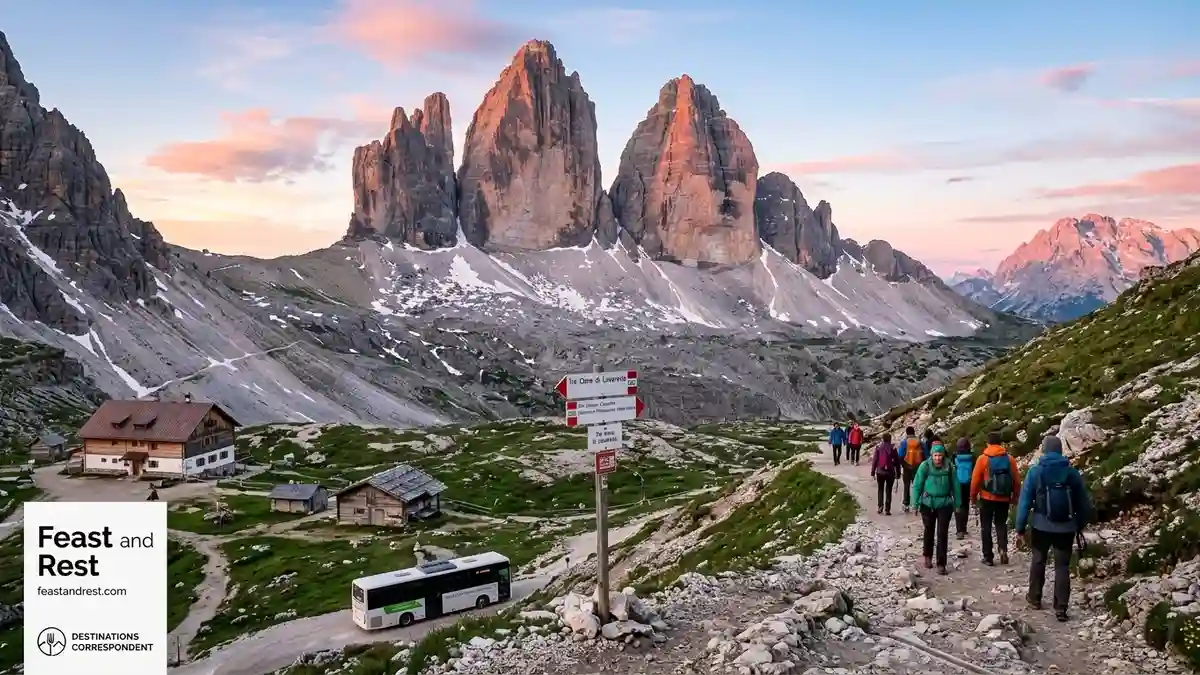
This unique geology produces the optical phenomenon known as enrosadira (or Alpenglühen). During sunrise and sunset, the pale dolomite rock faces reflect light, transforming the landscape into shades of pink, orange, and deep purple.
| Sub-System / Landmark | Primary Mineral Feature | Elevation Range | Key Structural Characteristic |
| Tre Cime di Lavaredo | Dolomitic Limestone | 2,300m – 2,999m | Isolated vertical towers |
| Marmolada Group | Dolomite / Glacial ice | 2,000m – 3,343m | Main regional glacier |
| Alpe di Siusi (Seiser Alm) | Sedimentary volcanic bedrock | 1,800m – 2,300m | Largest high-alpine meadow in Europe |
| Sella Massif | Plateau Limestone | 2,200m – 3,152m | Fortress-like central plateau |
Cultural Identity and the Ladin Tradition
The human history of the Dolomites is defined by centuries of isolation, regional self-governance, and cultural synthesis. The Ladin people, an ethnolinguistic minority residing primarily in the Val de Fassa, Val Badia, and Val Gardena valleys, have preserved their distinct Rhaeto-Romance language for over two millennia.
Following the dissolution of the Austro-Hungarian Empire after World War I, the northern sections of the range (South Tyrol) were annexed by Italy. This shift created a unique administrative framework where regional autonomy governs daily life, language rights, and historic land use. Traditional mountain architecture, known as maison clou or tobià (wooden timber-framed barns), remains a protected element of the rural landscape.
“The preservation of the Dolomites relies not merely on environmental conservation, but on maintaining the living cultural heritage of the alpine communities who have stewarded these valleys for generations.” — Dolomites UNESCO Foundation Report
What the Data Shows: Visitor Dynamics and Infrastructure Management
Tourism data provided by regional statistical offices (ASTAT South Tyrol and ISPAT Trentino) highlights significant seasonal influxes across the major valleys.
Annual Visitor Flow Distribution in the Dolomites
│
├── Summer (July–August): ~45% of annual arrivals
│   └── Focus: High-altitude hiking, Via Ferrata, cycle tourism
├── Winter (December–March): ~40% of annual arrivals
│   └── Focus: Dolomiti SuperSki network, alpine touring
└── Shoulder Seasons (April–June, September–November): ~15%
    └── Focus: Agritourism, cultural sites, low-altitude transit
To manage environmental pressure at sensitive sites like Lake Braies (Pragser Wildsee) and the Tre Cime di Lavaredo, regional authorities have introduced digital reservation systems, time-gated vehicular access, and expanded public shuttle networks.
Access Control Strategy: Lake Braies & Tre Cime
[Visitor Request]
       │
       ▼
[Digital Reservation Platform]
       │
  ┌────┴────────────────────────┐
  │                             │
[Slot Confirmed]        [Slot Capacity Reached]
  │                             │
  ▼                             ▼
[Permit Issued for        [Rerouted to Public Transit]
 Private Vehicle / Shuttle]     │
                                ▼
                        [Shuttle / Cable Car Transit]
Strategic Planning for Visitors
Navigating the Dolomites efficiently requires an understanding of seasonal closures, transportation logistics, and regional infrastructure.
Transport Infrastructure
Public Transit Networks: The Südtirol Mobil and Trentino Trasporti networks provide integrated bus and rail travel connecting main valleys to cable car hubs.
Cable Car Integration: Cable cars operate extensively from mid-June through September, and again from late November through April for ski season.
Vehicular Regulations: Mountain passes (e.g., Passo Sella, Passo Gardena) experience heavy seasonal traffic; several valleys enforce dynamic toll roads and restricted driving zones (ZTL).
Seasonal Considerations
Month-by-Month Accessibility Index
Jan  Feb  Mar  Apr  May  Jun  Jul  Aug  Sep  Oct  Nov  Dec
[═══ Winter Peak ═══]  [Off] [═ Summer Peak ═] [Off] [Peak]
Summer Season (Late June to Mid-September): All trails, rifugi (mountain huts), and high-altitude lifts are operational. High visitor density requires advanced bookings for accommodation and trail access.
Autumn Season (Late September to October): Reduced crowd levels, stable weather, and golden larch foliage. Some lift systems close by early October.
Winter Season (December to April): Focus shifts to snow sports via the Dolomiti SuperSki network, which spans 12 ski areas and 1,200 kilometers of tracks.
Spring Season (April to May): Low season characterized by melting snow and maintenance closures for cable cars and alpine huts.
Why This Matters: Environmental Sustainability and Community Impact
The balance between economic reliance on tourism and environmental preservation remains a key focus for local authorities. The impact of climate change on high-altitude alpine ecosystems is visible in the retreat of the Marmolada Glacier, driving updated municipal environmental policies.
Local initiatives focus on electric public transport, zero-emission alpine huts, strict regulations on new hotel construction, and the promotion of Agriturismo (sustainable farm stays). By encouraging extended stays and dispersing visitors across lesser-known sub-systems (such as the Friulian Dolomites or the Brenta Group), the region aims to safeguard both its ecology and cultural integrity for future generations.
Stay inspired with Feast and Rest!
—
Source and Data Limitations
This overview synthesizes data from the UNESCO World Heritage Centre, the Dolomites UNESCO Foundation, ASTAT (Provincial Statistics Institute of South Tyrol), and regional tourism bodies including IDM Südtirol and Trentino Marketing. Visitor statistics and seasonal transport regulations reflect data recorded through mid-2025. Access policies, including reservation requirements for high-density locations such as Lake Braies and Tre Cime di Lavaredo, are subject to periodic adjustments by local municipalities. Climate indicators regarding glacial retreat are based on glaciological surveys from the University of Innsbruck and ARPA Veneto. Unverified claims regarding future lift network expansions or unannounced environmental tariffs have been omitted.